Join Curify to Globalize Your Videos
or
By using Curify, you agree to our
Terms of Service and Privacy Policy
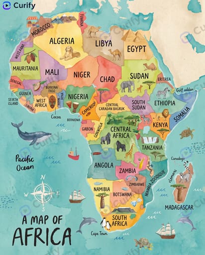
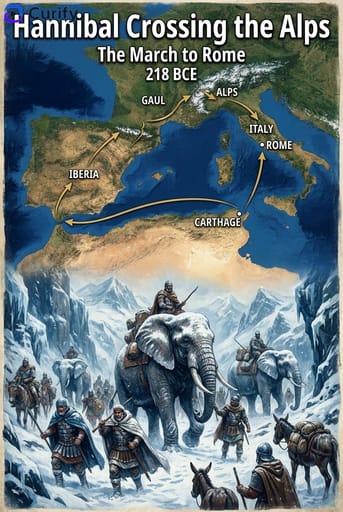
Trojan War Historical Event Map Illustration
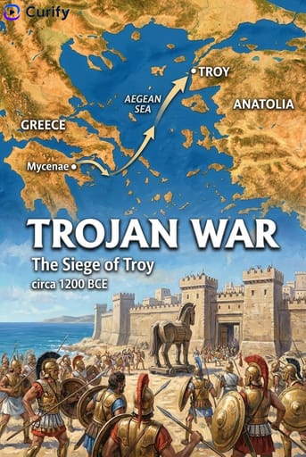
This example showcases a stunning historical event map illustration of the Trojan War, highlighting key locations and events that shaped this epic tale. Ideal for educators, history enthusiasts, and creators looking to enrich their projects with visual storytelling. Dive into the fascinating world of the Trojan War and enhance your presentations or educational materials. Discover how our AI prompt generator can help you create your own unique illustrations today!
Generate your own
Historical Event Name
Prompt
(Historical Event Map Illustrator) You are a professional historical infographic designer. Based on the user-specified trojan war, generate a vertical, two-part map and scene illustration, matching the watercolor/illustrative style of the reference images. Layout: 1. Top Section: Detailed map showing the event's route, key locations, and directional arrows, with clear labels for cities, regions, and bodies of water. 2. Bottom Section: Vivid, dramatic scene illustration depicting the key moment of the event (battle, march, disaster, etc.). 3. Header/Title: Bold title "{historical_event.upper()}" with a subtitle/date, Curify watermark at top left. Style: Warm, illustrative watercolor texture, historically accurate details, clear typography, vertical format, 4K ultra HD, direct image generation. Subject: trojan war Illustrated Route & Scene Map.Use this example for
More like this
Other nano banana templates
Explore other categories and presets.